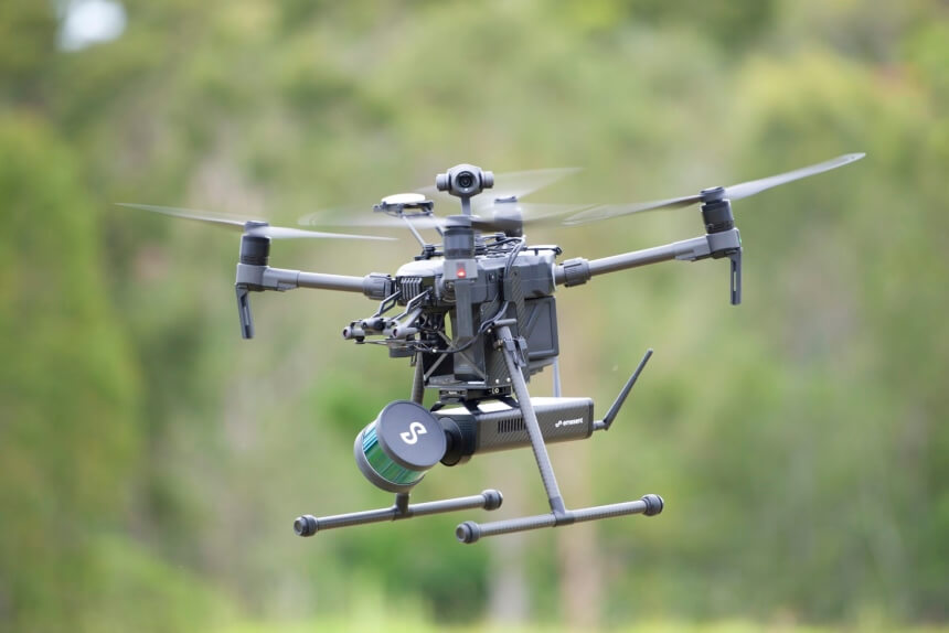
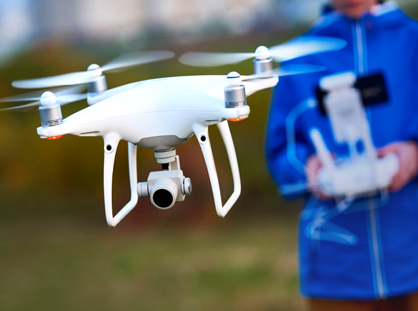
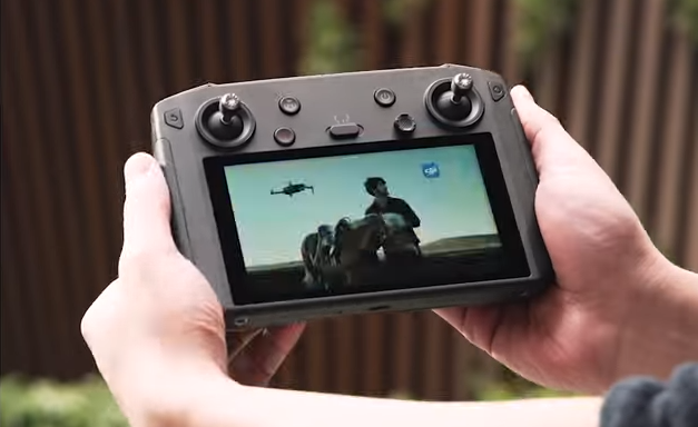
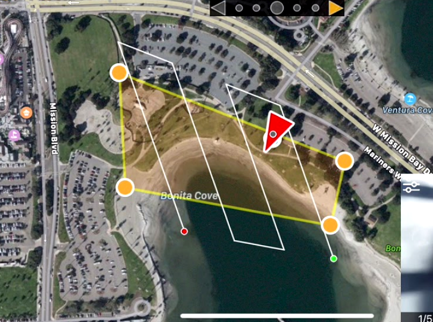
Drones are used for multiple purposes; one of the most common is drone mapping. It is the use of drone machines to search and collect data. The process includes mapping a location of your choice using a drone to create important outputs like digital elevation figures and 3D models.
Choosing the right software for drone mapping is essential when using drones to search for data, and with the rapid popularity of mapping software in the community, it’s impotent to understand it properly and how it works. Keep reading this article to learn more about it and understand the best available software.
Before we touch on the industries that use this software, it’s vital to understand that multiple drones are used for many things. You can find drones for videography, recreational activities, and even commercial uses like estate management. If you deal with properties and land and you’re searching for the best drone systems to help inspect properties, then you should view our list of the best drones for roof inspections. They can be used to get a better aerial view and look at properties from an entirely different perspective.
As previously stated, the number of industries that use drone mapping is overgrowing, and many free drone mapping software is available now. They’re used for different purposes, and various industries enjoy the positive impact of these drone software massively. Here are some of the top industries that use mapping software for drones and their applications.
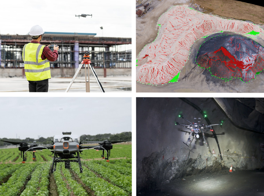
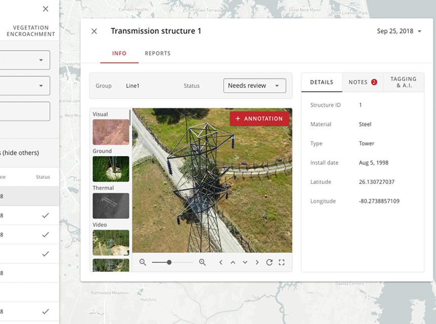
The construction and infrastructure industry have benefited from using drone software for mapping. Drone software for mapping is used in transport agencies, councils, and civil engineering industries. They’re used for different purposes in construction, such as using drone mapping to follow the progress of the site or terrestrial scanning to computerize installations. There are so many applications.
The data that drones collect can be used to compare as-designed to as-built plans and make progress, to save and share for analysis later. Mapping can also be used to document trenches, stockpile volumes, measure distances, and improve communication between workers to reduce the number of site visits by the workers and managers.
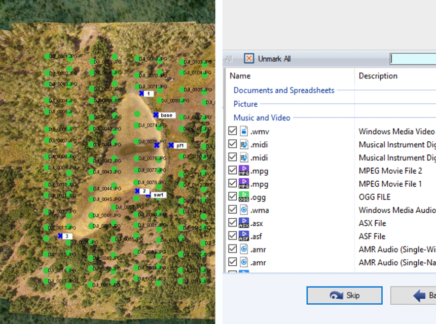
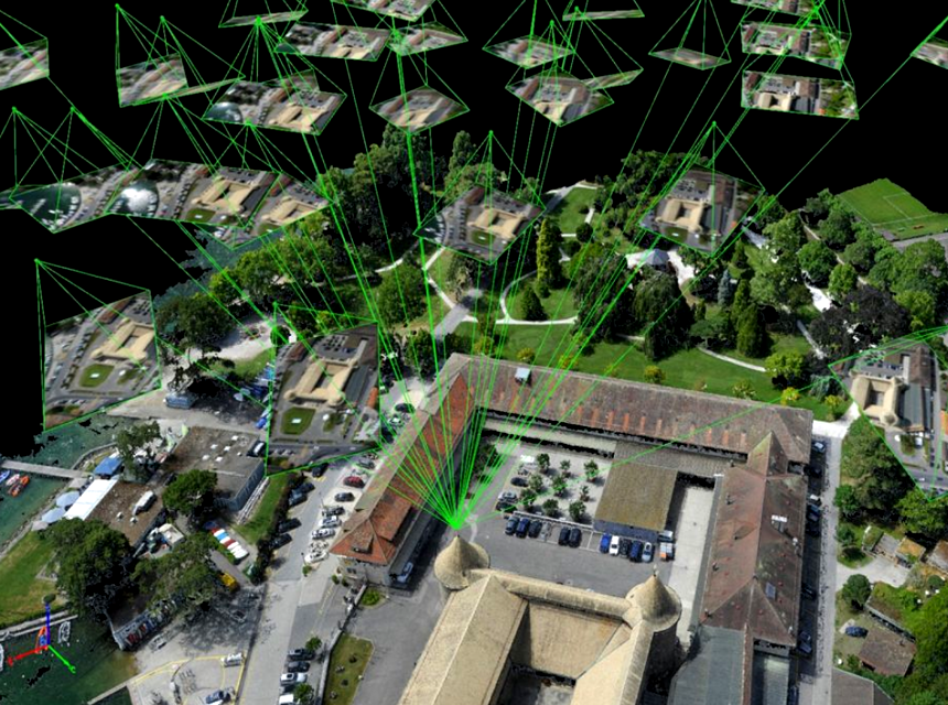
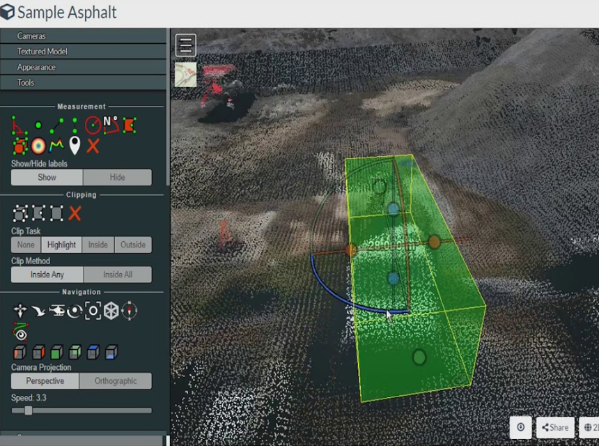
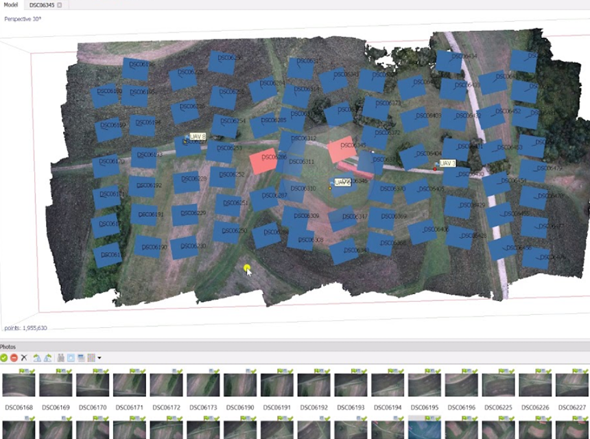
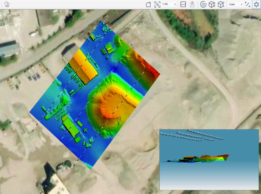
Multiple 3D mapping software for drones impact land surveying and help out workers. This software accompanies a surveyor when overseeing a project. It can be used to create a vastly detailed analysis of a particular location and get precise data on specific outputs essential to the project.
The drones drastically reduce the prices of topographic Trusted Source Topographical Survey | Definition Surveying A topographical survey for your project in Bay of Plenty, Hawke’s Bay or elsewhere on South Island will provide information for effective costing. www.definition.nz and land surveys, which makes them more accurate and efficient. Various drone software can produce detailed 3D models and create high-resolution ortho-photos.
Even in complicated or inaccessible environments, they can still create high-precision and good-quality maps as fast as possible. This software can be used, alongside the expertise of surveyors, to create high-quality and accurate maps for their clients. The DJI Mavic Air 2r will be an excellent drone to accompany you as it has the features to make the job easier.
The agricultural sector benefited greatly from this as various aerial mapping software for drones is used for different purposes around farmland. Agriculture is continually developing and evolving to maximize crop yields and reduce the need for pesticides and other chemicals. Drone mapping software can give farmers an overall aerial view of farmland; from above, they can see more of the land.
This software provides farmers with surface models and maps of the entire farm area and creates multi-spectral picture maps that farmers can use to analyze how different plants and crops on their land reflect light and how their health is on a cellular level. Other uses include the identification of crop diseases, tracking of growth, and creation of crop insurance claims against flooding or damage done by animals. If you’re having problems dealing with these pesty animals, you should check out this list of the best drones for hunting. They’re specialized drones that can help you identify wildlife.
Like the agricultural sector, another industry that benefits from the variety of free 3D mapping software for drones is the mining sector Trusted Source Mining | Department of Energy Supply and cost management–including energy costs–pose key challenges for U.S. mining companies. www.energy.gov . Several drone mapping software can be used to help professionals get aerial views of sites to improve planning, inventory, safety, management, productivity, and more. In the mining industry, it is vital that you use drones that come with RGB cameras, and this is to enable you to take pictures of the site from multiple angles.
Using quality drones is vital, and if you’re interested in getting a new drone with the best features for mining and other purposes, you should check out a compilation of the best drones under $2000. It’s a list of top-quality drone systems which have been used and trusted to deliver quality consistently.
Real estate is one of the used and important sectors where drone mapping software has really been helpful. Previously, there was a challenging and complex method for capturing properties from different angles. Still, with drone mapping software, you can quickly get a different view of buildings and perspectives. A drone that can be recommended for real estate photographers is the Ruko F11GIM2; it’s an affordable drone that can capture multiple views and perspectives. It can also reach heights that can be used to capture properties from above.
The size of forestlands and the number of trees in every forest makes it difficult to manage and monitor the entire land. Constant monitoring is tiring, time-consuming, and sometimes dangerous for workers. But it has been made easier since the use of drone mapping software.
When there is an environmental hazard emergency service, drone mapping software has proved to be vital and helpful. Technical workers can use this software to capture panoramic images of the disaster area in a short period, and a 3D representation can quickly be made. With 3D visualizations, it can be easier to monitor the area, significantly reducing the difficulty of finding and rescuing.
You should consider different things when choosing the perfect drone mapping software for you. Here are some of the things you should look at.
If you’re new to this, one of the essential features of drone mapping software that should be considered is the convenience of the software. Nobody wants to use software that they cannot understand, but rather easy software that is user-friendly and can easily be maneuvered around. The software should be self-explanatory, so it’s essential to research the software properly before getting it.
Another feature that should be considered is the format of files that is compatible with the software. If you’re going to use drone mapping software for commercial purposes, there will be times when you’ll meet clients that ask for various file formats. You must ensure that your software can export data in multiple file formats.
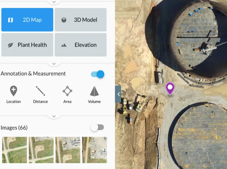
The ideal drone mapping software for you should be able to offer various services that are required for mapping. There are different features that the software should have, including communication. At the same time, recording and saving data in the cloud, processing, and the ability to export to various formats.
A vital thing you should look at when choosing a mapping software to use is customer support. The software developer should be able to help you if something goes wrong, but they should also provide the software with constant updates to keep it up to date also provide new users with a guide on how to use it.
Most software programs come with different subscription packages, and you can choose an affordable one. Although some software provides free subscription packages, they’re unreliable as they’ll expire after a while.
Here are some of the best drone mapping software. They include the following.
When looking at drone mapping software, one of the best options is the popular Pix4D. It has been in the industry for over ten years, and thousands of professionals use it. With time, the service has developed a large community of developers and users.
DroneDeploy is another excellent software that you can use. It is known for its user-friendliness and is a cloud-based mapping software that allows you to capture and analyze different data. Individuals in agriculture, mining, construction, and inspection mainly use DroneDeploy.
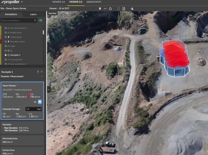
One of the mapping software that aids industries the most is Propeller. It is a turn-key solution that integrates into the workflow of different industries like construction, mining, and waste management. It’s created to make drone services and analysis more convenient and helps professionals track progress and visualize in 3D.
If you’re searching for more advanced drone mapping software, consider using Precision Hawk. There are different packages of software that will aid your needs and scale your organization’s growth.
WebODM is one of the most popular drone mapping software, and it acts as an open-source application that helps you create point clouds, maps, terrains, and 3D representations from aerial perspectives.
Agisoft is a mapping software that was created to help process photogrammetry data. This software allows you to process images conveniently and get 3D spatial data.
Maps Made Easy is a location-based mapping software allowing users to create new, high-resolution maps. It creates models and maps through aerial images.
Another exciting mapping software is SimActive, it enables users to process significant mapping projects and deliver excellent results. If you’re looking for a good option, then SimActive is fantastic.
Drone mapping is a widespread and valuable activity worldwide, and it’s important to choose the best software for drone mapping. When picking one, you should consider your needs, convenience, and familiarity with the software. It’s essential to also look at the price of the software you want to get, and you should always use one that you can afford.